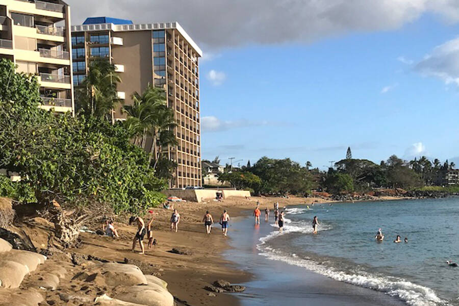
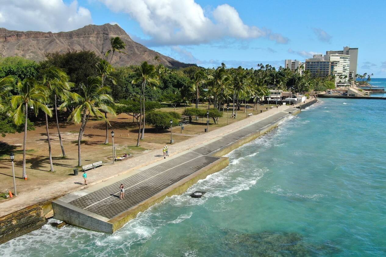
The Ala Wai canal that borders Waikiki is at risk of severe flooding in the event of a strong storm. Oceanit is helping to mitigate the damage with SWIFT tunnels.
In partnership with
Oceanit was contracted by the Honolulu City Council, Permitted Interaction Group (PIG), as an environmental consulting interface for the city, the U.S. Army Corps of Engineers, and local communities to assist.
01
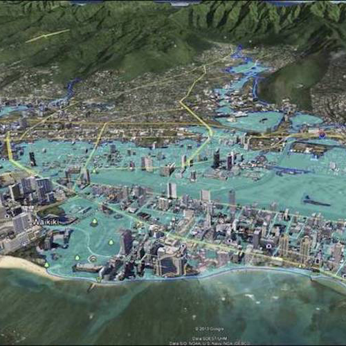
A devastating 100-year flood
The Ala Wai canal was originally built in the 1920s to drain the wetlands of Waikīkī and make way for development. Today, the canal is used for stormwater conveyance, and the waters carry sediment, bacteria, chemical runoff, and other pollutants.
Flash-flooding conditions can materialize within an hour in the upper portion of the Ala Wai watershed, creating significant damage downstream. In the event of a 100-year storm or flood, 3,000 structures could be damaged, which could cost more than $1.14 billion. Addressing this issue is of critical importance to protect the state’s primary university campus (UH Mānoa), the economic engine that is Waikīkī, and the neighborhoods of the watershed.

02
Oceanit joins the team
The Ala Wai Canal Flood Risk Management Project was launched by the U.S. Army Corps of Engineers (USACE), but initial plans for an engineering solution were met with criticism from local and state stakeholders. Stakeholder interaction during the early planning phases of the project was limited and created tension between the parties involved in executing the work, approving the work, and living in areas where work would affect daily life.
Oceanit was contracted by the Honolulu City Council, Permitted Interaction Group (PIG), as an environmental consulting interface for the city, the U.S. Army Corps of Engineers, and the local communities to assist.
03
A solution with local input
Utilizing our Design Thinking methodology, Oceanit’s goal was to improve the communication, cooperation, and understanding between all the stakeholders involved in this critical project. By hosting 13 community outreach meetings, both in-person and virtually, we were able to build up conversation among diverse stakeholders, receive and integrate their feedback, and offer updated insights to the community, city, and USACE.
USACE’s initial detention model was designed to retain water in detention basins in the middle watershed, which created concerns over the infrastructure that needed to be built in local neighborhoods. USACE then shifted to a conveyance model that put more water in the lower watershed. This also created concern within the community, especially residents.
To address this concern, Oceanit developed the SWIFT (Subsurface Watershed Inundation Flow Technology) design concept. SWIFT is a series of tunnels 2–3 miles underground that bypass the Ala Wai Canal — removing water from the lower watershed — and deposits the water into the ocean, 2,000 feet from shore.
The SWIFT concept balances stakeholder priorities, which include protecting Waikīkī without sacrificing our communities or ecosystems and bypassing the already delicate Ala Wai Canal.
FAQ
No, the tunnels are designed to convey a portion of the flood waters from the middle watershed to the ocean, bypassing the lower watershed. The tunnel size is restricted by the limitations in micro-tunneling capabilities. The main goal is to remove enough water from a 100-year flood event to match that of a 20–25-year flood event at the Ala Wai Canal, the current design capacity of the canal. The flooding of the lower watershed by local rainfall is not affected by the tunnels.
The tunnels are not a single standalone solution for the total flooding problems — they are part of a bigger solution. The Corps has a set of solutions separate from the tunnels to protect the watershed that they are still working on.
Right now, this is a conceptual design to describe the proposed tunnels in terms of a set of integrated ideas and concepts about what it should do, how it should behave, and what it should look like to help manage costs, assess risks, and evaluate the potential success of the tunnels.
The tunnels are concrete pipes underground. Access wells need to be located at strategic locations on the tunnel trace for construction and maintenance. From a planning standpoint, we found the optimum tunnel lengths and tunnel entrances are as follows:
Makiki: Below the confluence of Laneaole and Kanaha streams near the intersection of Wilder and Makiki streets, 9,100 feet
Mānoa: Downstream of the Woodlawn Bridge close to the boundary of Noelani Elementary School property, 12,500 feet
Pālolo: Near the crossing of Pālolo Avenue over Pālolo Stream, 11,200 feet
We have proposed the use of a weir (a low dam built across a river to regulate a river’s flow) that runs across the stream to control the flow of water in Mānoa Stream. The weir will allow the stream water to flow normally until such time the water level in the stream rises to that of a 20–25 year flood event. At this point, the weir siphons off the excess water and sends it to the tunnel entrance.
The stormwater being discharged from the SWIFT tunnels will be significantly cleaner than the stormwater that goes into the Ala Wai Canal and makes its way out through the canal and the harbor into the nearshore marine ecosystem. The water is captured in the upper watershed before it has a chance to pick up significant sediments. The weir used to capture the stormwater will help to remove some of the debris.
As a conceptual design, there are currently lots of unknowns. As a result, the initial cost estimates are very high, having included lots of contingencies built into the estimates. The estimates will be formalized as the unknows become known. This should result in lower cost estimates. The current estimate for the three 10-foot diameter tunnels is about $710 million. This breaks out as follows:
Makiki: $202 million
Mānoa: $266 million
Pālolo: $242 million